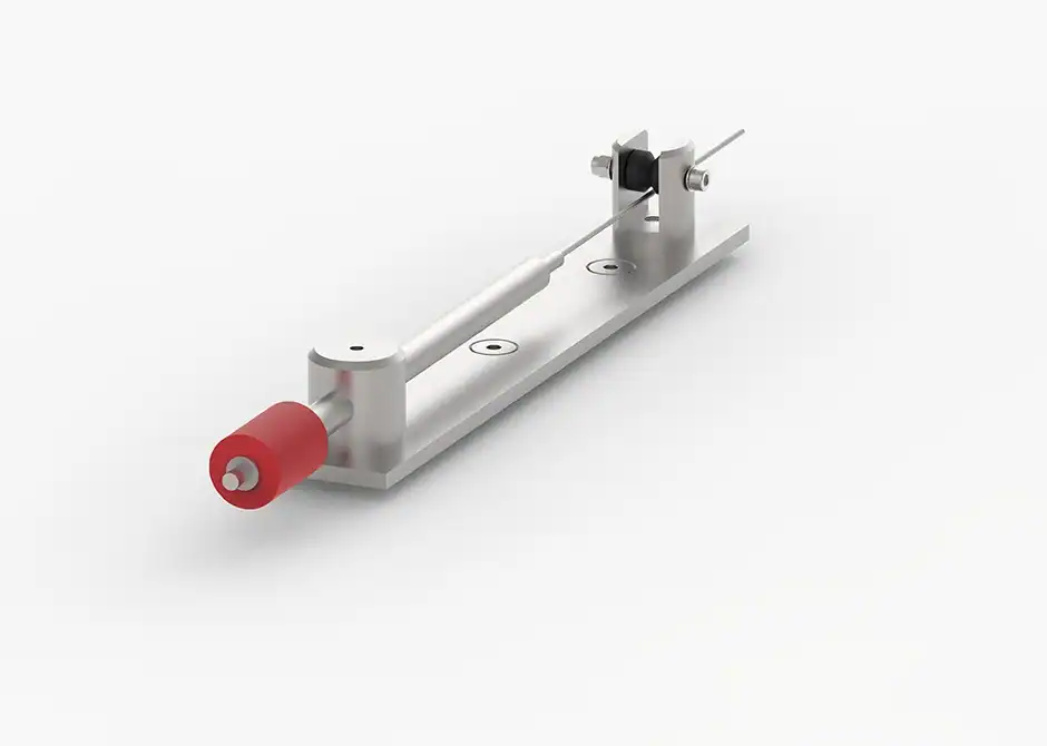
Wire Extensometer GEO-DW300
The GEO-DW300 Wire Extensometer from Geosense is a dependable solution for tracking ground and structural movement with precision and stability. Designed for long-term geotechnical monitoring, this instrument measures displacement along boreholes, tunnels, retaining systems, and other critical structures that require continuous deformation assessment.
With its robust build and straightforward installation, the GEO-DW300 delivers reliable readings even in challenging field environments. The system works by anchoring a wire to a fixed reference point, allowing the instrument to detect and record any extension or contraction caused by subsurface movement. Because the mechanism is mechanical and direct, the measurements remain consistent with low drift, making it ideal for long-duration monitoring programs.
To support diverse engineering needs, the instrument is compatible with various data logging setups. This ensures seamless integration into real-time or periodic monitoring workflows. Whether deployed in landslide zones, dams, embankments, tunnels, or excavation projects, the GEO-DW300 provides engineers with clear insight into deformation trends. By combining durability, measurement stability, and flexible deployment options, it becomes a trusted tool for geotechnical and structural engineers who need accurate and continuous displacement data.
Key Features
-
High-accuracy displacement measurement using tensioned wire mechanism.
-
Durable construction, designed for long-term field deployment.
-
Compatible with manual and automated data logging systems.
-
Low-drift mechanical design for stable readings over time.
-
Versatile installation across boreholes, tunnels, slopes, and structures.
-
Fast setup and minimal maintenance, simplifying field operations.
Advantages
-
Reliable long-term performance, even in harsh environmental conditions.
-
Straightforward installation reduces deployment time on active sites.
-
Consistent and repeatable data, supporting early-warning applications.
-
Suitable for multiple geotechnical scenarios, enhancing project flexibility.
-
Cost-effective for continuous deformation monitoring, especially in remote areas.